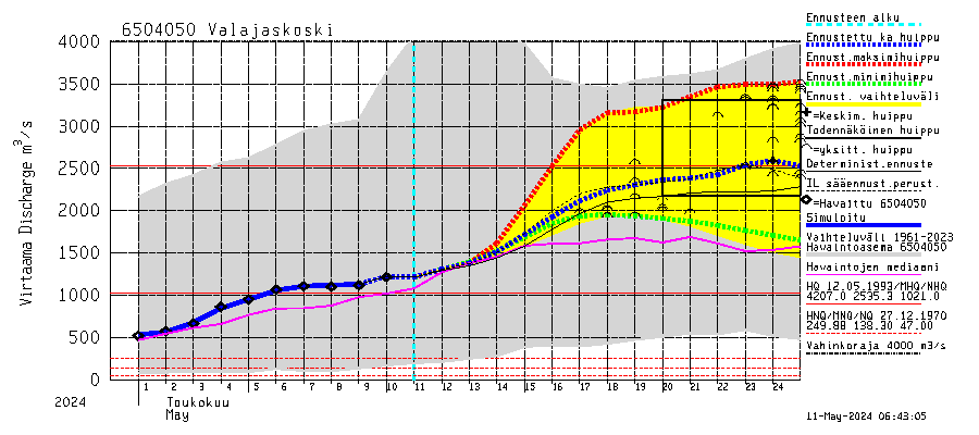
Hydrological forecast
|
Flood hazard maps (modeled)
- discharge 5100 m3/s (pdf
0,3 MB)
(a 250-year frequency flood)
- discharge 4700 m3/s (pdf
0,3 MB)
(a 100-year frequency flood)
- discharge 4400 m3/s (pdf
0,3 MB)
(a 50-year frequency flood)
- discharge 4000 m3/s
(hazard-limit)
Existing satellite images
Project concerning flood mapping is ongoing and therefore maps
presented in this service are only indicative and they should not be used
for civil protection or any other purposes. All rights reserved. Feedback:
Jari Silander and Mikko Sane,
email: firstname.surname@ymparisto.fi |